
Ice out Report 2020
May 10, 2020
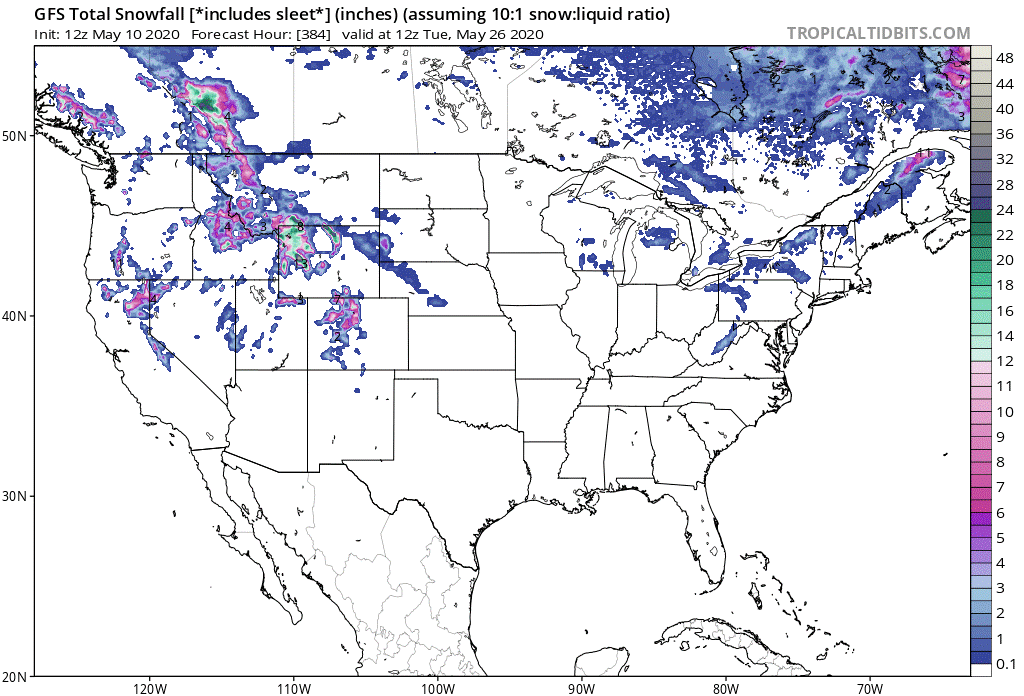
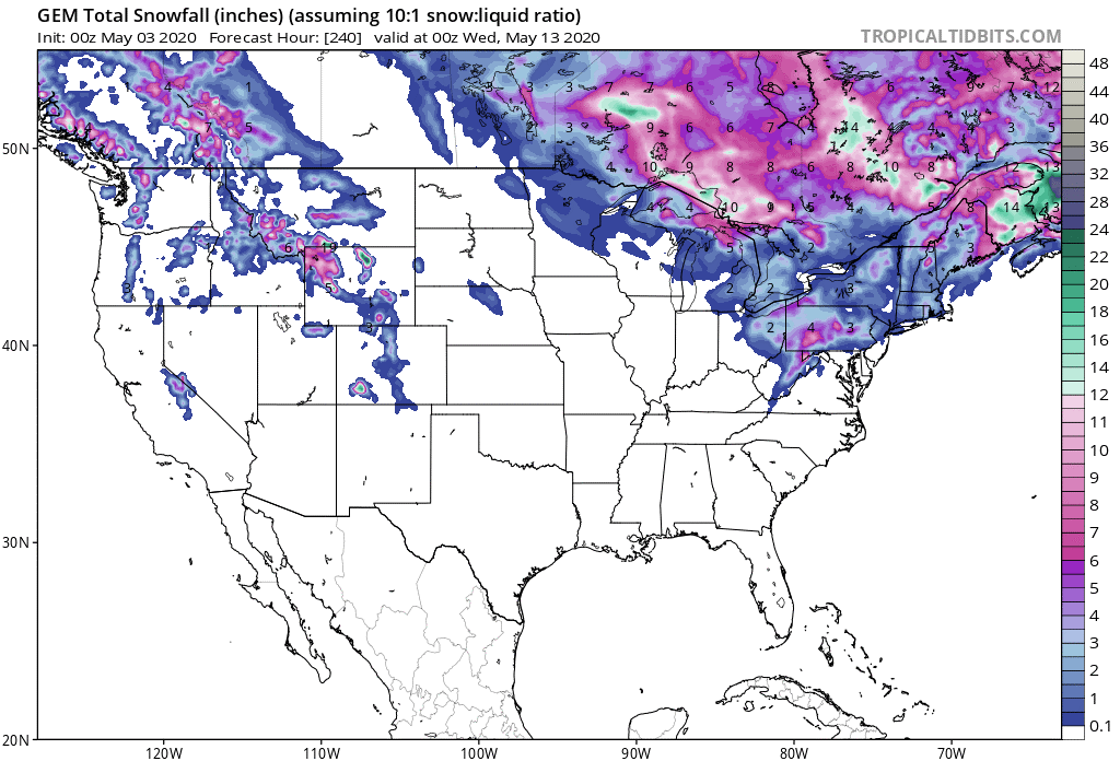
In the last update I made a big deal about how the long string of days with low temperatures BELOW freezing had ended and that I thought that we might be turning the corner for a few days before a big push of cold air arrived. Well, that didn't exactly happen other than the cold air. The string of days with low temperatures ABOVE freezing lasted just 1 day...yes 1 day. And to make it worse, not only did low temperatures drop below freezing last week, but the high temperatures dropped below freezing as well. Low temps last week ranged from -3C (26.6F) to -9C (15.8F). The high temp did climb to 12.7C (55F) on May 5 before dropping below freezing on May 7, 8, and 10. The GFS model won the battle with the Canadian model with regards to snowfall in the area last week. The Canadian was forecasting a bigger snow while the GFS was only forecasting a little and that exactly what the region saw - a little. There was 1cm on the ground May 3 and 2cm on the ground on May 7 but all is gone again now.
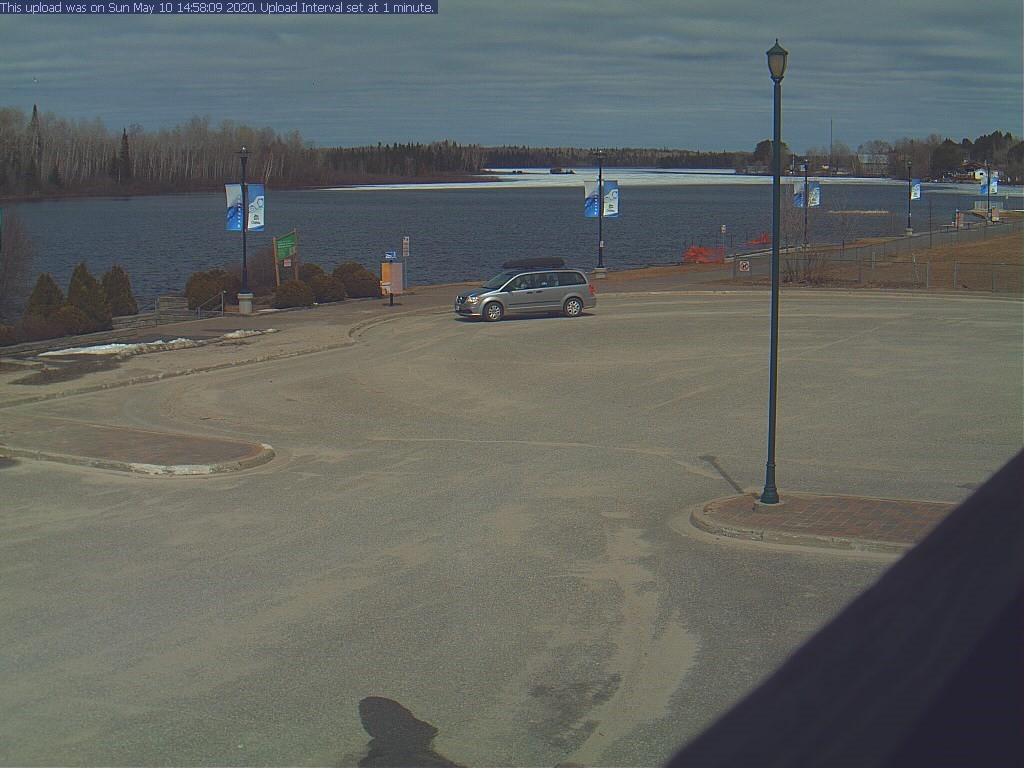
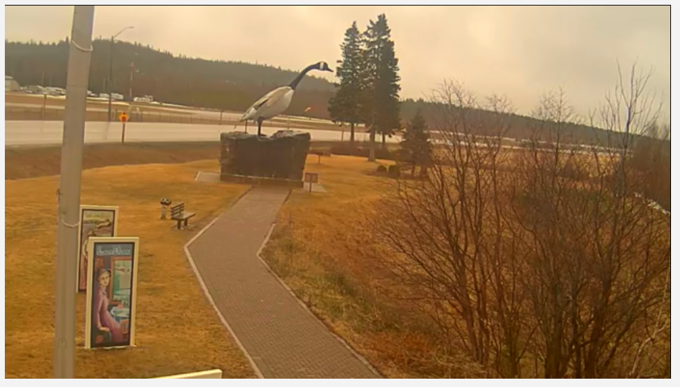
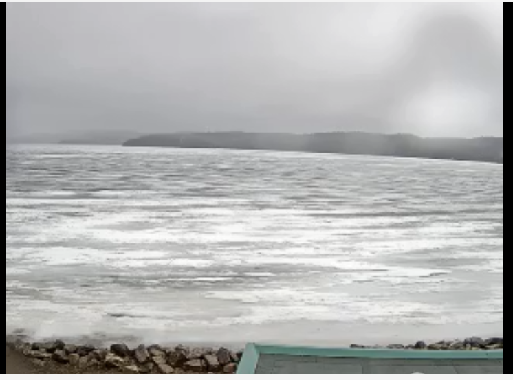
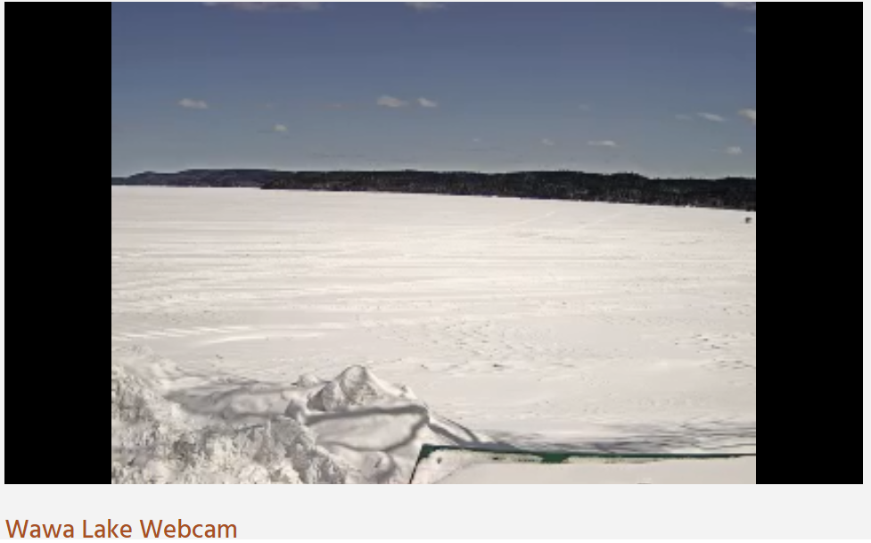
The two web cams I have available are starting to look real good with a lot of open water showing up. Here's what is's looking like in Chapleau and Wawa.

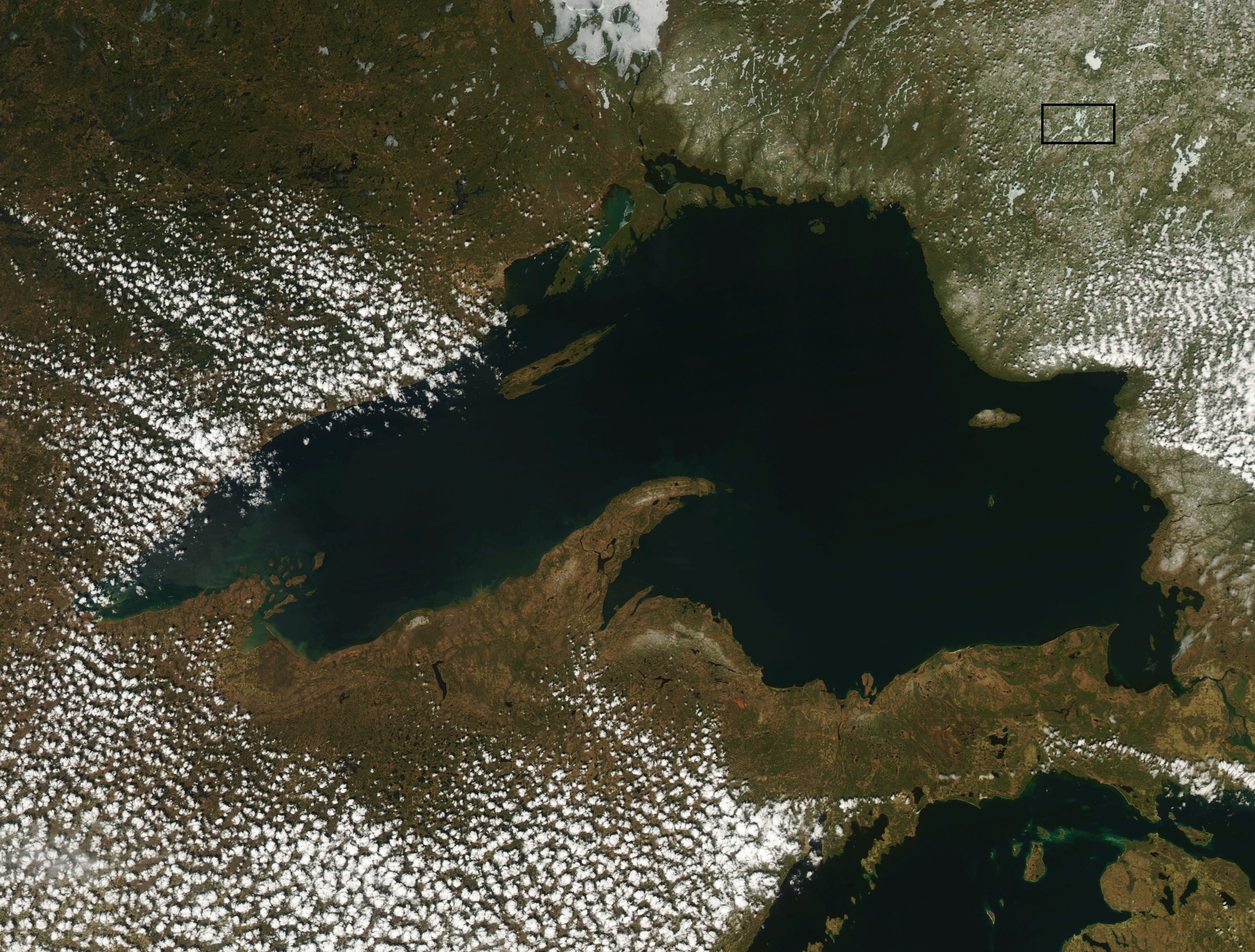
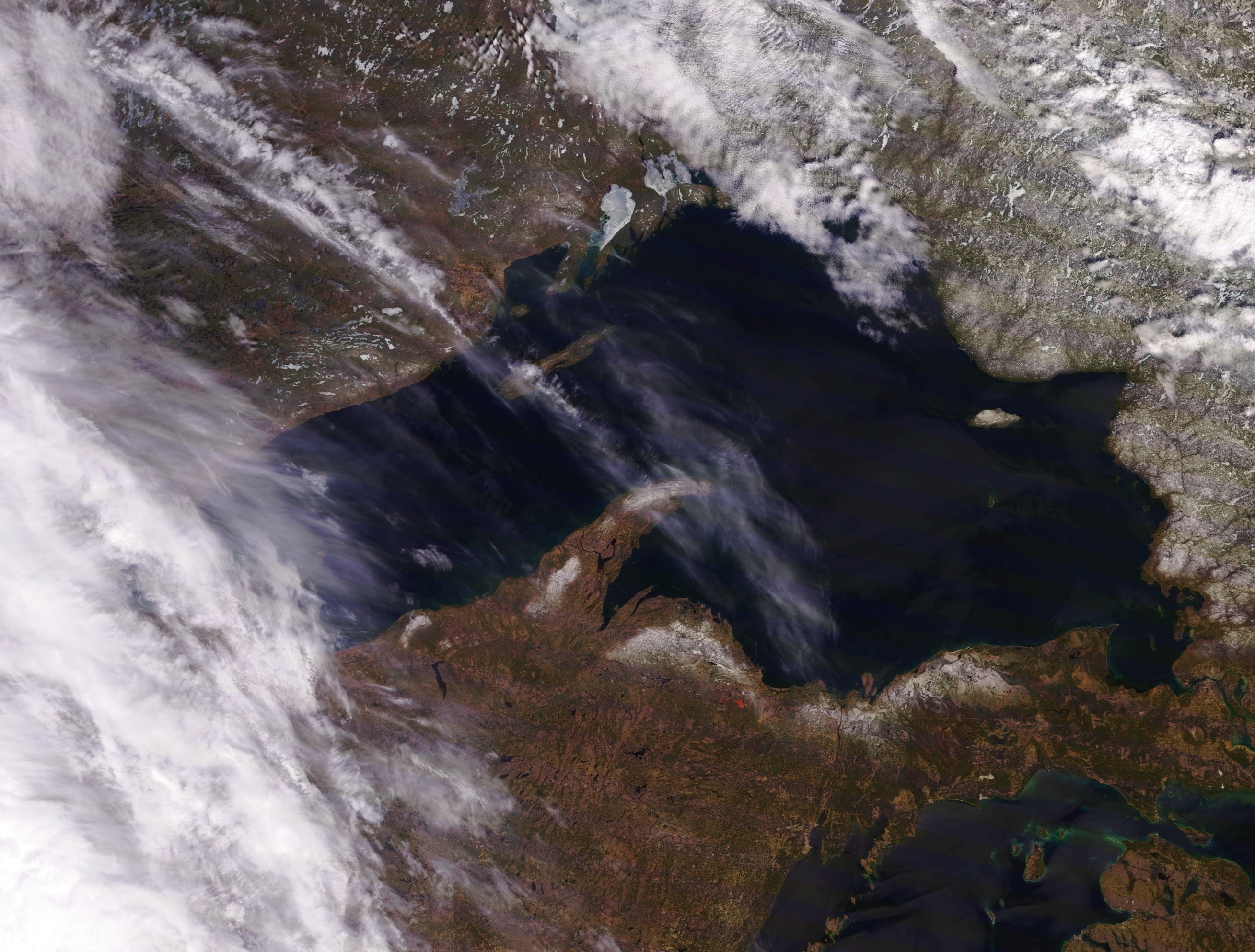
Here's the best satellite shot of Lake Superior in recent days as most are covered with heavy clouds. It's from May 6. Obakamiga (Buck) and Granite Hill lakes are located in the square box. As you can see, they are still very white.
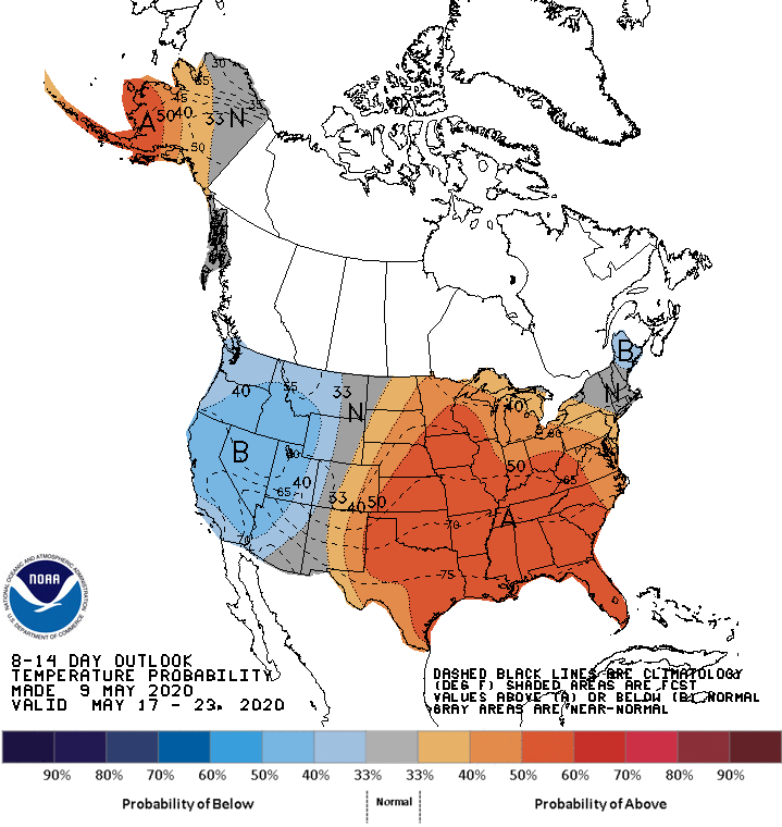
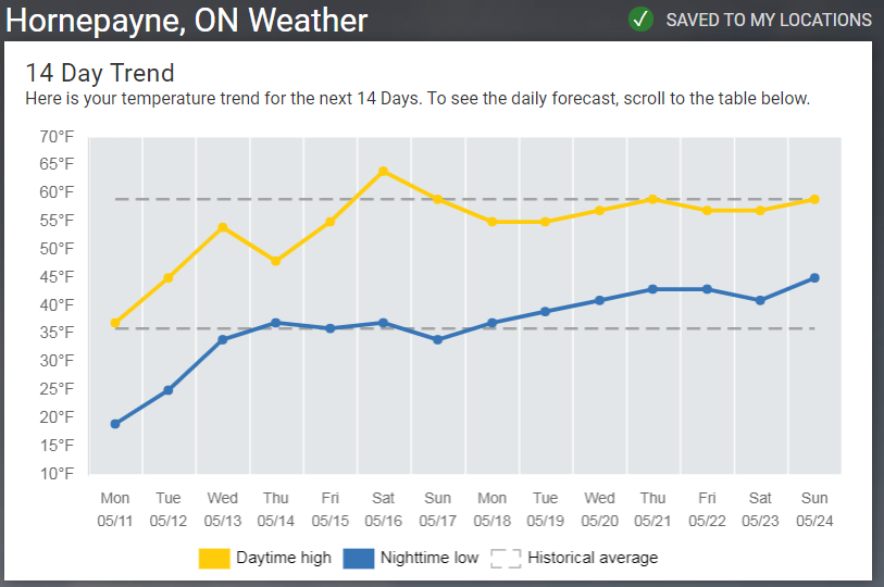
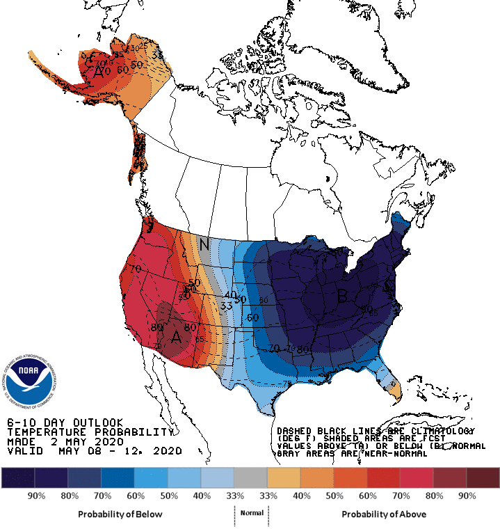
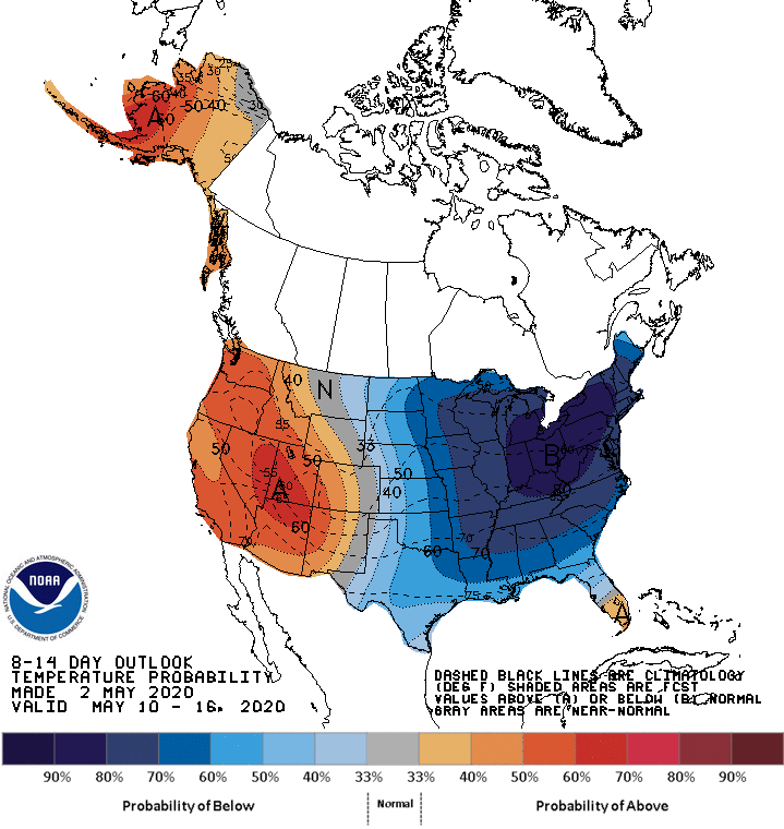
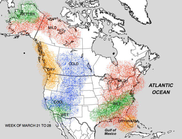
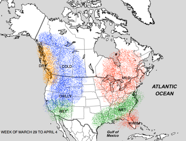
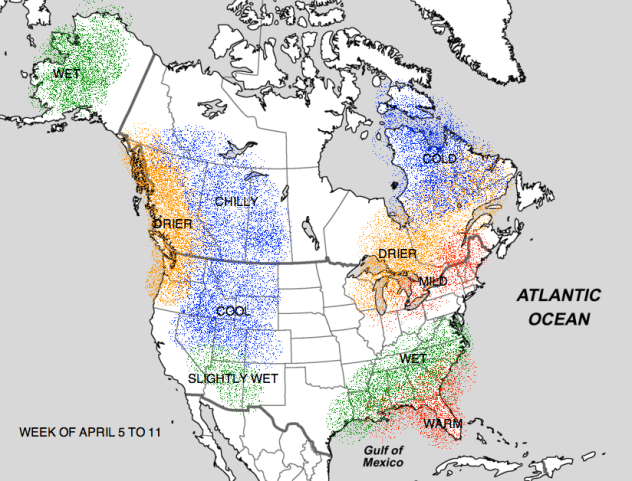
Speaking of white, I did get this quote from Forde Lake Air on the status of the ice on Government Lake. "Snow machines are still running across it. It's looking white right now but turning hot in the next couple of days so that should kick the (heck) out of it". Keep in mind that "hot" is a relative term, but will it warm up in Hornepayne? Almost all guidance says that temperatures will at least get back to seasonal averages for this time of year. Here are the longer range forecasts from the CPC and The Weather Network.
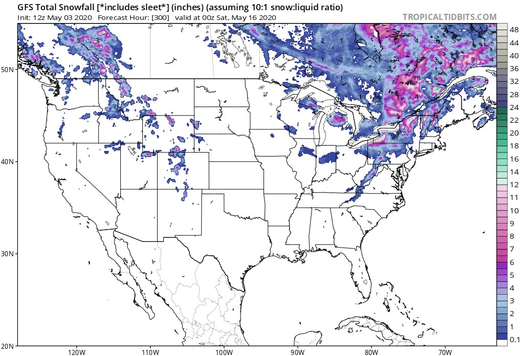
The GFS has also come around to Spring and is forecasting no snow in the area. The little snow painted around Hornepayne is from today (May 10) with nothing after that.
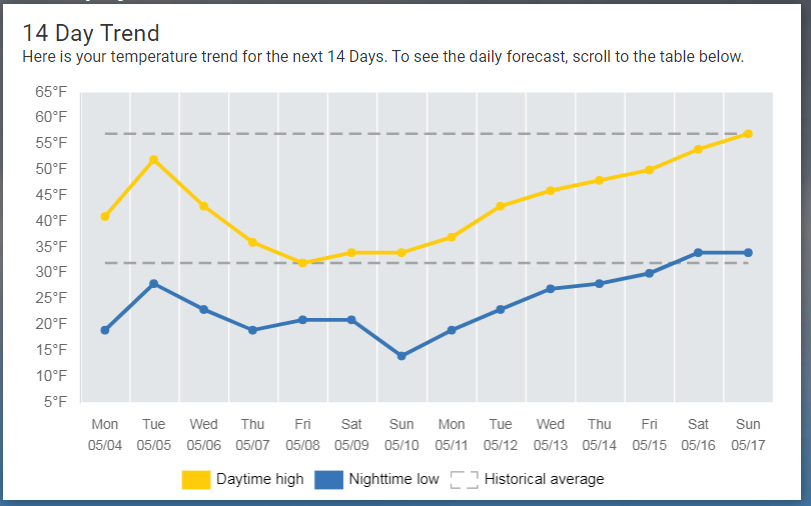
Environment Canada is forecasting a very cold start to the week with 0C forecast for a high temperature tomorrow but warming to 16C (61F) by next weekend. The interesting question is whether this will be enough warmth to remove the ice by the opening of walleye season next Saturday, only 6 days away. I remember my first year at Buck in September 1996 meeting folks that had to reschedule their trips from the first two weeks of the season because the ice had not gone out. My memory is not what it used to be, but I'm not sure that has happened since then. In most years, having the ice linger this long would be a very big deal and our hosts would be scurrying around trying to get to camp, to get open, and to start receiving guests. This year, maybe not so much with the closure of the border. I'll pass on any updates as I receive them!
Stay safe everyone!
Jeff
May 3, 2020
What a wonderful week of Spring weather for Hornepayne last week. Each day experienced high temperatures between 10C (50F)) and 16.5C (62F) and yes, the string of low temperatures below freezing was finally broken yesterday (May 2) when the low only reached 1.4C (34.5F). The coldest temperature of the week was -6.5C (20F) but that was early in the week. The Spring weather finally worked it's magic reducing the snow cover in Hornepayne from 40cm (15.7in) down to ZERO as reported by Environment Canada! Wow, did it go quickly at the end. The Wawa Goose webcam confirms the bare ground. You can also see a lack of white in the Lake Superior satellite shot. The inland lakes are still white but the surrounding land areas are starting to look a little greener - especially out west of the big lake.
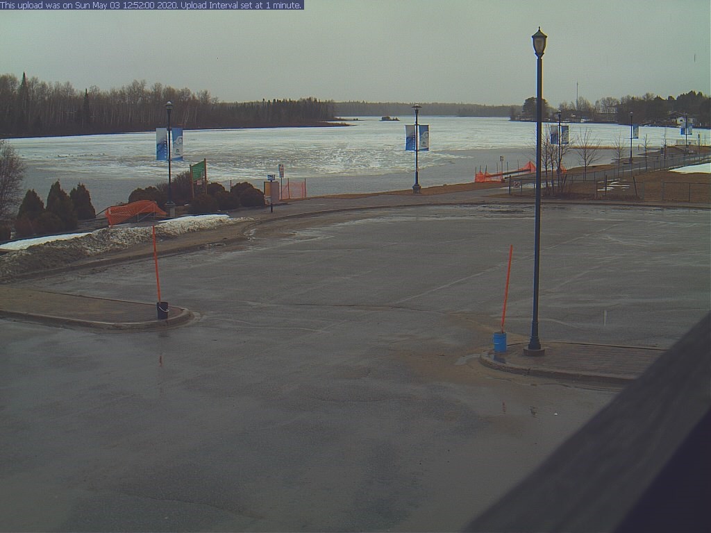
I predicted last week there would be water in the picture from the Chapleau webcam and sure enough, there is some...actually quite a bit. The webcam of Wawa Lake shows the ice is softening but not much water to speak of yet. That should change by next week.
The short term forecast for Hornepayne looks to continue some nice temperatures after today's rains but then the trend will reverse once again and put the region back to below average temperatures. Here are the CPC and The Weather Network's ideas for temperatures for the next two weeks. Still warm enough to melt ice, especially if sunshine is available, but it could certainly slow it down some - especially if low temperatures start dropping below freezing at night again. It looks like it could take the next two weeks to get back to average temperatures for the time of year.
Even the European model is on board with the cool down for next weekend.
Our friend, the GFS model, is not forecasting much if any snow in Hornepayne over the next 16 days but the Canadian (GEM) model has different thoughts. I'd probably stick with the GFS in this case though.
So, that's it for now. The region is moving toward ice out even though it may not be as quickly as last week. Hopefully it won't be too much longer for those that can safely travel to camp. Stay safe everyone!
Jeff
March 22, 2020
Greetings during this extremely difficult time. I pray for good health to all who see this and a swift resolution to this pandemic so that we can get the border open and travel to our favorite places in the whole world!!! Keep the faith!!
We're still in March so any melting we see up north is going to be baby steps and that's exactly what we saw last week last week in Hornepayne. The high temperatures were at or below freezing for all but one day as Wednesday, March 18 experienced a high temperature of 2.5C (36.5F). Hornepayne had a cold week, but the coldest days were March 20 and 21 when the temperature bottomed out at -27.5C (-17.5F). The cold temps were accompanied by a big snowstorm as well. Heavy Snowfall Warning were raised for 10 - 20 centimeters of snow and they picked up 16 centimeters. The snow pack grew from 75 to 91 cm but a sunny day yesterday has already cut it back to 84cm. Last year on this date, the snow pack was only 62cm. So, while we have less ice to melt than last year, we have more snow to remove.
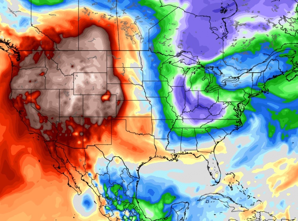
Here's a really good satellite picture of the state of Michigan from March 17 which accurately shows the snow remaining on the ground and the frozen lakes. Any lake that is white has solid ice and lakes where the ice is gray are in transition. It appears that we have open water in the southern two thirds of Michigan.

While the ice out line is progressing north through Michigan, the Wawa Lake webcam shows that Winter is still in control in the north country.
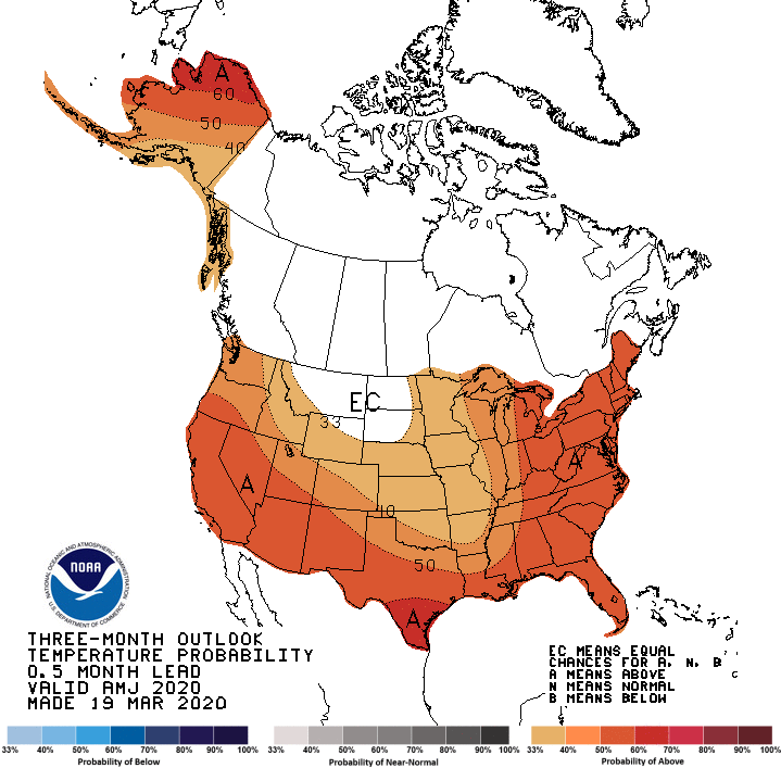
What does the future look like? Early evidence is that we will continue to be on the mild side of average. That doesn't mean that there won't be periodic shots of colder air, but in general, the temps look milder. Here's the Spring outlook from NOAA (National Oceanic and Atmospheric Association) in the US. It's calling for a warmer than normal Spring.
The European model backs that up with it's weekly outlooks into mid-April.
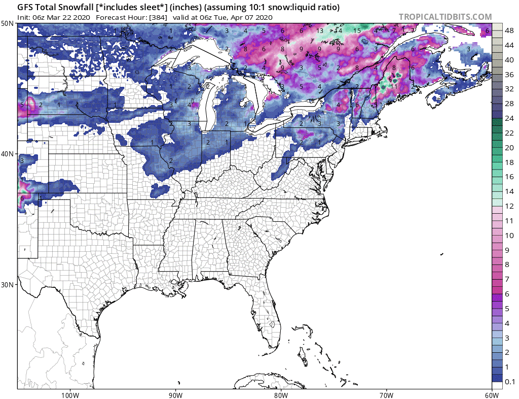
The US GFS model shows some snow over the next 16 days, but at this time, it's not really that much.
Well, there you have it for this week’s update. Back to my show on the 40th anniversary of the Miracle on Ice. Everyone stay healthy and support one another. See you next week!
Jeff
March 16, 2020
Hey there - we're back for another year of Ice Out reports. Before we look at the Winter in Hornepayne, lets review the ice out dates the last few years. Remember, the ice out date is a very fickle date. First, no one is usually there to witness the ice leaving and second, the ice rarely leaves a lake all at the same time. It can sometimes take days for all of the ice on a lakes to melt. So, just keep in mind that this is not an exact science.
2019 May 18
2018 May 10
2017 May 10
2016 May 6
2015 May 8
2014 May 26
2013 May 20
2012 April 7
2011 May 7
Winter in Eastern North America was milder than an average Winter. One reason for this was the speed of the polar vortex which was at record levels almost every day in January and February. When the vortex is strong, it does not allow Arctic air to escape the Arctic region and head south into Canada and the US. As a result, temperatures were on the milder side of normal. Hornepayne's northern latitude isolated it from many of the wild temperature swings but they were not immune from some of the effects of the mild Winter. For example, last year (2018-2019), Hornepayne experienced a stretch of 78 days, from December 20, 2018 through March 9, 2019 that the temperature remained below freezing. This year, the longest streak at or below freezing was only 55 days from December 28 through February 20. That streak was halted with a 3.5C (38F) high on February 21 and a very balmy 8.6C (47F) degree day on February 22. Although the Winter was on the milder side, Hornepayne still had some bouts with extreme cold. January's coldest temperature was -32.7C (-27F) and the coldest reading of the Winter was a chilly -38.8C (-38F) on February 13.
Let's look at the mean temperatures (average of highs and lows) for the month of February over the last ten years. February 2020 is the third warmest behind 2017 and the dreaded 2012 when the ice went out on April 7. I don't see evidence to support that happening again this year though.
2020 -13.5C
2019 -17.4C
2018 -16.2C
2017 -12.7C
2016 -16.2C
2015 -23.5C
2014 -18.1C
2013 -16.8C
2012 -11.4C
2011 -15.7C
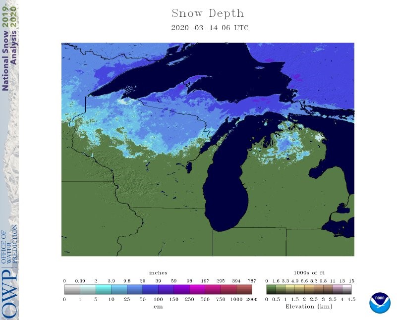
Snow accumulated for good on November 5 and has been on the ground ever since. To see how this years snow cover compares to other years, here's the snow depth, in centimeters, on March 14 for the last few years according to Environment Canada:
2020 75
2019 71
2018 77
2017 37
2016 62
2015 103
2014 107
2013 82
2012 70
2011 75
The above table illustrates that Hornepayne did get about average snow this Winter, but it was no where near the brutal Winters/Springs of 2013 and 2014 where the ice hung on almost to opening day. Here's the snow cover that we have today.
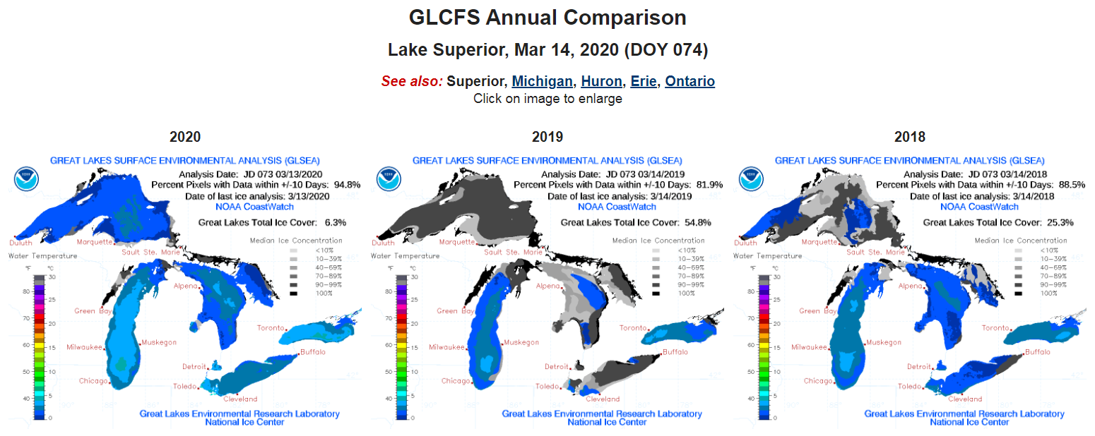
While the snow might have been around average this Winter, the ice on the Great Lakes was anything but average. Here's the ice coverage today compared to the last two years - only 6.3% compared to 54.8% last year. To put this in perspective, last year, Great Lakes ice reached a seasonal high of almost 76% in early March.
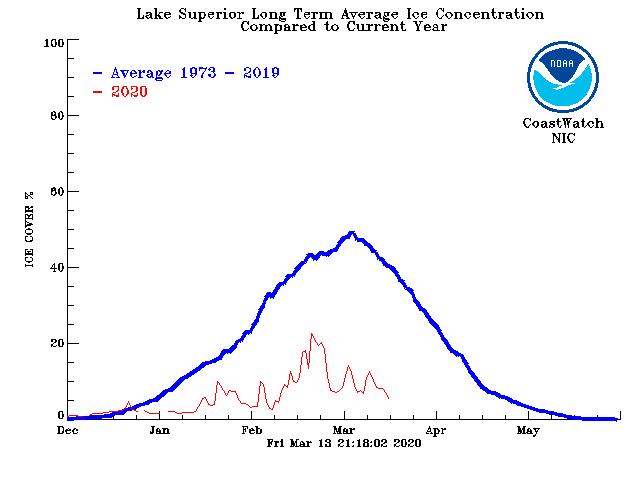
This next graph shows how the ice season went on Lake Superior compared to the most recent long term average. The maximum ice on the big lake was only around 20% and that was in late February. It's been on the decline since.
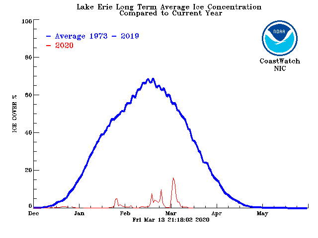
Even more striking is the ice on Lake Erie - the shallowest of the Great Lakes and the one most likely to freeze. Erie could only produce a paltry 15% in early March! Most of the winter, Erie was less than 10% ice covered. Here is a comparison against the long-term average.
Here's the best satellite shot I could find of Lake Superior and it's from March 10. You have to look really hard to find ice and it's totally restricted to the smaller bays.
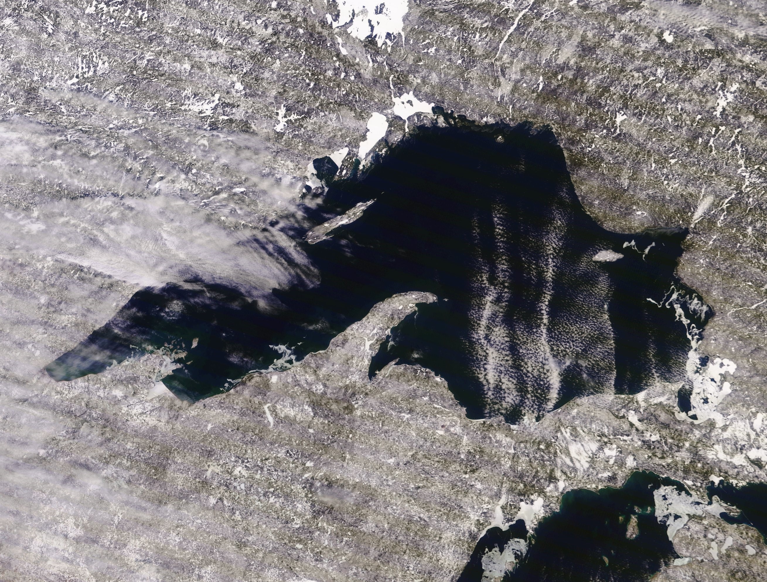
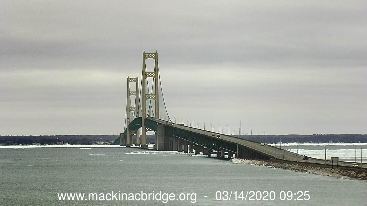
In the lower right hand corner of that picture, you can some ice still in the Straights of Mackinaw. Checking the bridge webcam shows the ice is already breaking up and there's open water. There was not open water in the straights last year until April 20, over a month later.
So we know the Winter was milder and as a result, there will not be as much ice to melt. What do the future temperatures look like? The CFSv2 is the US long range climate model. It's run every day and often changes each time it's run. Nonetheless, here's what it's showing for late March and early April. Temperatures look to be right around average for the next several weeks. The March 1 run of the model was showing a warm April for the Hornepayne region, but it has been trending cooler and cooler since the early runs. The Weather Network is forecasting only 2 days above freezing in the next 14 days.

So, the melt is on and we are definitely ahead of last year when the ice went out on May 18. I always throw out a guess on when I think the ice will go out. I'd like to call it an educated guess but it really relies more on luck than education. If you look at the ice out dates in the past, May 6 through May 10 is a pretty popular time frame. However, I think that we have a jump start on the process, so I'm going to guess that the ice goes out on May 2. What's your guess? There will be more updates to come as we move through the ice melting season.
Jeff